Landscape
Timanfaya National Park
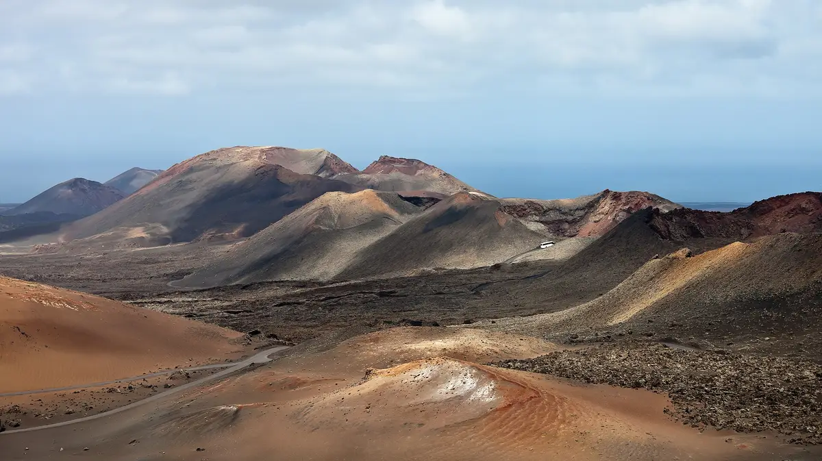
Tour a landscape formed by historic eruptions, where underground heat still turns water into steam
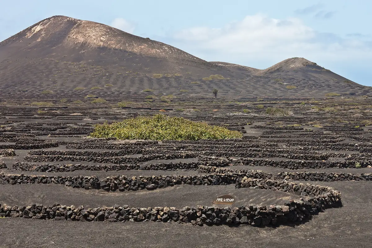
Across La Geria, vines sit in hollows dug into volcanic gravel, with low stone walls shielding them from the wind. This wine-growing landscape in Lanzarote is as much about farming as geology. People come to see the repeated shapes of the planting pits and the practical ingenuity behind crops grown in volcanic terrain.
Planning a whole day from a base nearby? See things to do in Puerto del Carmen.
The defining features of La Geria are its conical planting hollows, known as gerias, and the small dry-stone walls that shelter them. Rather than standing in continuous rows across exposed soil, vines grow down inside these depressions. The surface material is lapilli, a loose volcanic gravel called rofe locally. Around the plants, the scooped-out ground and stonework create a repeated pattern across the cultivated landscape.
These shapes have practical jobs. The hollows allow the plants to reach fertile soil beneath the volcanic covering. Above it, the layer of rofe reduces moisture loss through evaporation and transpiration. The depth and shape of each hollow provide shelter from the wind, reinforced by the additional stone wall. What looks like a carefully arranged pattern is a response to the conditions in which the crops must grow.
Malvasía is an abundant grape variety here, grown for wine production. Vines are not the only plants cultivated this way: fruit trees, including figs, also grow in sheltered hollows. Alongside the grapes, these trees show how the same planting method supports different crops.
La Geria covers 5255 hectares across the municipalities of Yaiza, Tías, Tinajo, San Bartolomé and Teguise. It is an extensive landscape rather than an attraction contained within a single building or enclosure. The vineyard hollows are its identifying feature, but the protected area brings together cultivated ground, small settlements and volcanic landforms.
The area received protection as a natural park in 1987 and was reclassified under legislation in 1994. It is also designated as a special protection area for birds. Agriculture is therefore part of the protected landscape itself: the vines, excavated hollows and dry-stone walls are central to what makes La Geria distinctive.
The protected area also includes the natural monument of Cueva de los Naturalistas, a large volcanic tube. Along its western edge lies Los Volcanes, the natural park surrounding Timanfaya National Park. For a visitor choosing between La Geria and Timanfaya National Park, La Geria's particular draw is the cultivated volcanic ground: crops rooted beneath gravel, with shelter built around them.
A closer look at the cultivated ground reveals how much of La Geria's appearance comes from the relationship between the plants and their shelter. The vine occupies the lower part of a hollow, while the volcanic gravel slopes towards it. The dry-stone wall adds another protective boundary above the depression. Together, the hollow and wall reduce the crop's exposure to wind without enclosing it in a building.
The contrast is between the loose rofe covering the ground and the stones assembled into walls. These are separate parts of the growing system: the gravel helps retain moisture, while the stonework provides additional wind protection. Beneath the visible covering lies the fertile soil reached by the roots.
Fig trees provide another concrete detail to look for among the cultivated plots. Their use of the same sheltered planting method makes clear that the hollows are not simply a feature of wine production. La Geria's landscape records a broader way of growing crops in volcanic ground, with each planted depression shaped around the needs of the plant.
La Geria is best approached as an agricultural landscape, with the planting pits and stone walls as the main things to see. The interest is outdoors and spread across cultivated ground rather than concentrated in a hall or exhibition. A visit centred on the vineyards can focus on the shape of the hollows, the volcanic gravel and the relationship between each plant and its shelter.
Wine provides the agricultural context, particularly the abundant Malvasía grape variety. Seeing the growing method does not depend on drinking wine: the visible features explain how vines and fruit trees can take root beneath the volcanic covering. The walls and hollows are working parts of that system, not decorative structures.
The area's extent across several municipalities also matters when planning. La Geria is not just a point within Yaiza, even though Yaiza forms part of it. Its protected landscape reaches into Tías, Tinajo, San Bartolomé and Teguise, so the name refers to a broad area of vineyards, settlements and volcanic terrain.


La Geria extends across Yaiza, Tías, Tinajo, San Bartolomé and Teguise. Its protected landscape covers 5255 hectares, so it is an area rather than a single attraction entrance. Along its western boundary is Los Volcanes, the natural park that surrounds Timanfaya National Park. Vine-growing is its most recognisable feature.
The hollows help vines reach fertile soil beneath the volcanic gravel while sheltering them from wind. Small dry-stone walls provide additional protection. The surface layer of lapilli, locally called rofe, reduces moisture loss through evaporation and transpiration. The same growing method is also used for fruit trees, including figs.
Yes - the main landscape interest is the planting system, which you can appreciate without drinking wine. Conical hollows, loose volcanic gravel and low dry-stone walls give the cultivated ground its distinctive appearance. Malvasía vines are abundant, but fig trees also demonstrate how this method supports crops in volcanic terrain.
Malvasía is an abundant grape variety in La Geria, where vines are cultivated for wine production. The plants grow in conical hollows in the volcanic gravel, with small dry-stone walls providing extra shelter from wind. The landscape is distinctive for this growing method as well as for the crop itself.
Keep going
Tour a landscape formed by historic eruptions, where underground heat still turns water into steam
Human figures, a refugee boat and marine growth turn the seabed into an underwater sculpture gallery
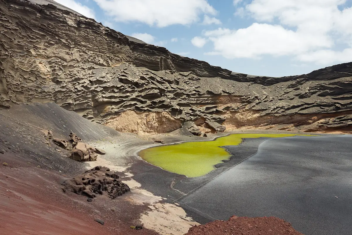
A green coastal lagoon between a volcanic crater and a black shore, seen from a footpath viewpoint