Landscape
Timanfaya National Park
Tour a landscape formed by historic eruptions, where underground heat still turns water into steam
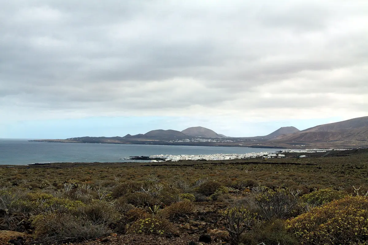
Natural inlets, partly enclosed by walls built by residents, are the main draw in Punta Mujeres. This coastal village in the municipality of Haría lies near Lanzarote’s north-eastern tip, north of Arrieta. People come for the pools and a village stop close to Jameos del Agua and Cueva de los Verdes.
The pools sit within the village itself, where natural coastal coves have been adapted with walls built by local residents. Their defining feature is that mixture of an existing shoreline and practical construction: the coves were already there, while the added walls helped enclose them. These are coastal bathing places rather than conventional swimming pools, so a dip depends on the sea conditions on the day. Rough water is a reason to stay out, regardless of how enclosed a pool appears.
A visit centres on the village shoreline, looking at the inlets and the walls that distinguish the pools from the surrounding coast. The setting also connects Punta Mujeres to the volcanic landscape nearby. The village stands at the southern edge of the La Corona natural monument, a protected area formed by the La Corona volcano. Jameos del Agua and Cueva de los Verdes lie within that area, less than 2 km from Punta Mujeres, making either a nearby addition to a coastal stop.
The name Punta Mujeres is older than the settlement. It appears on maps by Leonardo Torriani as the name of the geographical feature, but its origin remains uncertain. Local explanations belong to legend rather than established history: women abandoned here by pirates in one account, and rocks resembling the silhouettes of women in another.
Settlement began much later, with a pair of families who farmed the land and fished. The construction of saltworks on the coast subsequently brought population growth. Punta Mujeres then developed as a residential settlement, with tourism accelerating its expansion in more recent years. By 2016, it had 1059 residents.
That sequence gives the village a history beyond its bathing pools: cultivation and fishing came first, followed by salt production, housing and tourism. The saltworks belong to the story of how the settlement grew; the clearest visitor-facing example of residents changing the shoreline is the wall-building around the natural coves. Those pools remain the village’s distinctive coastal feature.
Punta Mujeres is on the coast of the municipality of Haría, near the north-eastern end of Lanzarote. Arrieta lies to the south, while the LZ-1 provides the road connection with Arrecife. For a driving itinerary, those are useful geographical anchors: Punta Mujeres is a coastal village stop, with nearby volcanic attractions that can be combined with time beside the water.
The village pools and the attractions around La Corona offer different kinds of visits. At Punta Mujeres, the focus is the open shoreline and the natural coves modified by residents. Jameos del Agua and Cueva de los Verdes are separate destinations within the protected volcanic area, rather than features in the village itself. Their proximity makes a combined outing practical without turning the village into merely a name passed on the road.
Arrieta is the neighbouring village to pair with Punta Mujeres if the day is centred on this stretch of coast. For a shorter stop, the pools provide a clear focus without adding another attraction.
What distinguishes Punta Mujeres is the way its principal attraction was made. Residents added walls to natural coves along the coast, adapting places already cut into the shoreline rather than creating an entirely separate bathing complex. The result is a series of coastal pools within the settlement, where the built elements and the natural shape of the inlets can be seen together.
That local construction also fits the village’s broader relationship with the sea. Fishing supported the earliest families, and coastal saltworks later helped the population grow. The pools represent another use of the same shoreline, this time for bathing. They are the feature to concentrate on during a village visit, rather than treating the historical saltworks as a confirmed sightseeing stop.
Compared with a visit centred on one of Lanzarote’s named beaches, Punta Mujeres offers coves enclosed in part by walls. The appeal is that particular form of coastal bathing, although entering the water should always depend on the conditions, not simply on the presence of a wall.

The coastal pools are bathing places, but entering the water depends on the sea conditions. They are natural coves partly enclosed by walls built by residents, not conventional swimming pools. Check the water from shore before considering a dip, and stay out when waves or currents make conditions uncertain.
Punta Mujeres is connected with Arrecife by the LZ-1 and lies north of Arrieta on Lanzarote’s north-eastern coast. It belongs to the municipality of Haría. If you are planning a driving route, it can form a coastal stop alongside Arrieta or a visit to nearby Jameos del Agua and Cueva de los Verdes.
Yes, Jameos del Agua and Cueva de los Verdes are less than 2 km from Punta Mujeres. Both lie within the protected volcanic area of La Corona, whose southern edge meets the village. A visit to either can be combined with time at the village’s coastal pools, with bathing dependent on sea conditions.
The origin of the name is uncertain, although it appears on maps by Leonardo Torriani before the village developed. One legend links it to women abandoned here by pirates; another suggests that nearby rocks resembled women’s silhouettes. Neither explanation is established as the definitive origin of the name.
Keep going
Tour a landscape formed by historic eruptions, where underground heat still turns water into steam
A subterranean salt lake and lava openings form the setting for César Manrique's cultural centre
Enter a drained lava tube with illuminated cave walls and a concert hall near its entrance