Landscape
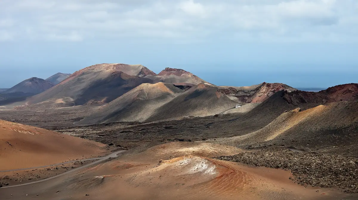
Timanfaya National Park
Tour a landscape formed by historic eruptions, where underground heat still turns water into steam
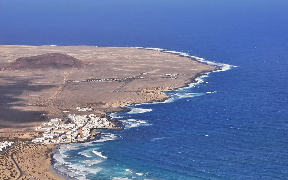
At the southern end of Playa de Famara, Caleta de Famara brings the village and the beach together beneath the Risco de Famara. This coastal settlement in the municipality of Teguise grew from a fishing enclave into a place largely used for holiday homes. Visitors come for the shoreline and the beach’s cliff-backed setting.
Caleta de Famara occupies the southern end of Playa de Famara, on the western coast of the municipality of Teguise. The beach extends along the foot of the Risco de Famara, giving a visit its clearest geographical focus: the settlement at the end of the sand, with the cliff rising behind the beach. The village and the beach are distinct places, although their names are often shortened in conversation.
The LZ-401 connects Caleta de Famara with Teguise, the municipal capital. For a coastal outing from Teguise, that makes the village a straightforward destination to pair with the beach rather than a separate inland stop. Time here can be divided between the settlement and the shoreline, without treating Playa de Famara as a different excursion.
Caleta de Famara had 1107 inhabitants in 2019. Its later development has centred on holiday use and second homes, a change from the fishing activity that originally brought buildings and then permanent residents to this stretch of coast.
Caleta de Famara emerged as a fishing enclave towards the end of the eighteenth century, but permanent settlement came later. Around 1818, its buildings amounted to dry-stone storehouses used to shelter boats during the fishing season. In 1850, the settlement was still recorded as having no inhabitants. Buildings served the fishery before they supported a resident village.
Families began settling here from 1888, including arrivals from La Graciosa. In 1909, Caleta de Famara had three buildings, twenty-four storehouses and twenty-five inhabitants. The imbalance between storage buildings and residents gives a particularly concrete picture of its early character: this was a working place for boats before it became a village of homes.
The surrounding Famara area has an older history, with remains of pre-conquest Indigenous settlements. Franciscans established themselves nearby in 1413 and remained for around 33 years. Their construction marked the beginning of the first hermitage in the Canary Islands dedicated to the Virgen de las Mercedes. That earlier religious presence belongs to the wider area, rather than to the later fishing village’s foundation.
The name Famara has been linked to water collected on land rather than to the sea. Wölfel proposed that it derives from Famagui, a term used by Maciot de Béthencourt for the natural rainwater basins in the area. These depressions, known as maretas, accumulated rainfall and supplied water to visiting expeditions. The proposed derivation connects the name with a practical resource on this coast: places where rain could gather and be collected.
This is a different strand of local history from the village’s fishing origins. The rainwater basins, the earlier Indigenous settlements and the Franciscan presence all belong to the wider Famara area; Caleta de Famara itself developed later as the fishing enclave at the end of the beach. Its subsequent shift towards holiday accommodation and second residences added another use to the same coastal setting. The village visible today is therefore not simply the settlement described in the early records of boat stores, even though fishing explains how that settlement began.
The most direct reason to visit Caleta de Famara is its relationship with Playa de Famara. The village sits at the beach’s southern end, so the settlement and the shore form a natural combined outing. A visit focused on the village alone would leave out the long beach beneath the Risco de Famara that defines its position on the coast.
Teguise is the clearest place to combine with Caleta de Famara by road, since the LZ-401 links the coastal village with the municipal capital. The distinction is useful when planning: Caleta de Famara is within the municipality of Teguise, but it is a separate settlement beside the sea. The beach is likewise a distinct place rather than another name for the village.
For an outing built around local history, the early dates explain the settlement rather than identify a surviving monument trail. The documented dry-stone boat stores describe its beginnings; they should not be confused with a promise of historic buildings open to visitors today.

Caleta de Famara is at the southern end of Playa de Famara, on the western coast of the municipality of Teguise in Lanzarote. The beach stretches beneath the Risco de Famara. Although it belongs to the municipality of Teguise, the village is a separate coastal settlement, connected to the municipal capital by the LZ-401.
Caleta de Famara is the village, while Playa de Famara is the adjoining beach. The village occupies the beach’s southern end, and the sand extends beneath the Risco de Famara. They fit naturally into the same outing, but the distinction matters when choosing between spending time in the settlement and concentrating on the shoreline.
Caleta de Famara began as a fishing enclave, with permanent residents arriving after its boat-storage buildings. Around 1818, dry-stone storehouses sheltered fishing boats; in 1850, it still had no inhabitants. Families began settling from 1888, including people from La Graciosa. Later development shifted towards holiday use, and the village is now largely associated with second homes.
The LZ-401 connects Teguise with Caleta de Famara. It links the municipal capital with the coastal village at the southern end of Playa de Famara, making the settlement and beach a logical combined outing from Teguise. The village is within the same municipality, but it is not part of the town itself.
Keep going
Tour a landscape formed by historic eruptions, where underground heat still turns water into steam
A subterranean salt lake and lava openings form the setting for César Manrique's cultural centre
Enter a drained lava tube with illuminated cave walls and a concert hall near its entrance